Friday 25 February 2022

Different Types of Maps

 This week our focus was on learning about different types of maps. The students read about different types of maps using a selection of books on EPIC. We worked on their summarizing skills using boxes and bullets. When they found the main idea, they wrote it in their own words in a box, and then used bullet points to write down any supporting details that they came across.

Once they finished researching different types of maps, they created handmade pamphlets to teach others about the different types of maps that they had researched. They printed out examples of the different maps, and then wrote short descriptions explaining each type. The students will share them with each other on Monday, so those who have not finished will need to do so over the weekend.


Thursday 17 February 2022

Location! Location! Location!

 That's right, this week was all about locations. Not just about any location in particular, but about being able to use grids, lines of latitude and longitude, and coordinates to find different countries around the world, or different cities and features on the map of Japan.

We began using simple grids, like those found in an atlas which has a grid with quadrants with letters on one axis and numbers on the other. Our focus was on building practical mapping skills, and the students quickly improved as they played a game of Battleship against a partner,


From there, we went on to learn about the different types of lines that divide up the Earth on a globe or map; the lines of latitude and longitude. We labeled the main lines of latitude such as the Equator, polar circles, Tropics of Cancer and Capricorn, and the prime meridian. Then we learned how to find coordinates by using the different lines of latitude and longitude. Together with a partner, the students were given maps and sets of different location coordinates to find. As the maps were all in Japanese, the students were paired up so that at least one of them would be able to read the names on the map. It was a good challenge that not only involved social, and mapping skills, but Japanese language skills as well.


In math, we learnt different methods to multiply.


Wednesday 9 February 2022

Finding Out More about Where We Are in Place and Time

This was a short, but busy week as we continued finding out more on the topic of maps. The week began with a test on the world map, focussing specifically on where the 7 continents and 5 oceans are located. 


Two other things that we worked on in the unit this week were sorting out the similarities and differences between maps and globes, and expanding our knowledge and understanding of Japan by labeling the 4 main islands and major cities on a map of Japan. The learners had a chance to use Google Maps to help them locate the various islands and cities so that they could add them to their own map.


Next week, we will continue to learn about how to navigate using the lines of latitude, longitude, and grids. We will also be taking a look at some of the many different types of maps and their uses.

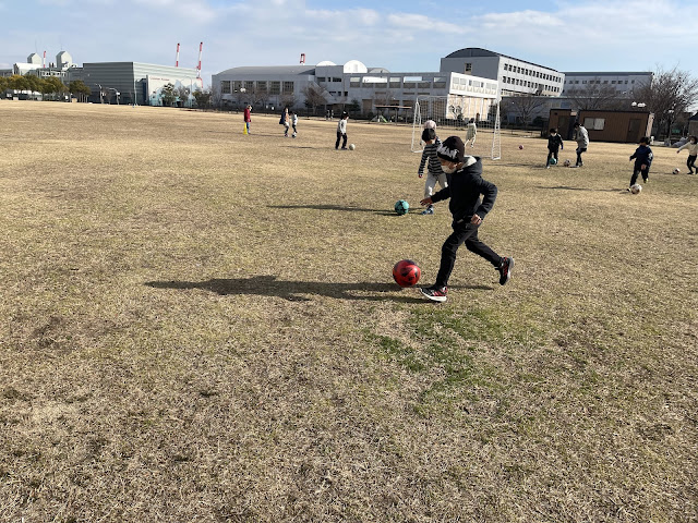
In PE we also found connections to our mapping unit, by looking at how coaches and players might use a map of a soccer field or other sport's field with their players to show where to move to on a play. We also looked at the terms for different parts of the soccer field such as the end line/ goal line, sideline, center circle, etc., and also discussed some of the rules in relation to the different parts of the field. For example, when the ball crosses over the sideline, then it has to be thrown in by the team that didn't kick it out. 


We then went outside to practice our skills and had a short soccer match. The students did a fantastic job of carrying our 2 large soccer goals to the greenfield demonstrating some of those teamwork skills that we focussed on at the start of the year. It was really great seeing everyone working together for a very literal common goal! I just wish that I had taken a photo of it!


In math, we continued working on solving problems involving area, perimeter, and multiplication. 

During language time, we reviewed how to use proper punctuation when writing statements, questions and exclamations. But the highlight for many students seems to have been the start of a novel read-aloud of the novel, Rebel and the Library of Ever. In preparation for their own reading group/ novel studies which we'll be starting soon, the students have been taking notes on the different elements of the story such as details about the main characters, the setting of the story, and keeping track of any questions they have as well as problems that arise in the plot. Several of the students are really enjoying the story so far, so much so that they beg me not to stop at the end of each chapter! 


Friday 4 February 2022

Where in the World Are We?

 This week began with a look at what the students knew about the map of the world. Give a blank sheet of paper they were asked to draw a map of the world with as much detail as they could and to include whatever things they felt a world map should have. Many quickly looked to the window, but the large map of the world was not there! So they really had to draw it from memory.  It was definitely a challenge for most!


To help build their knowledge, they were given blank world maps and tasked with finding and labeling the seven continents and five oceans as well as a few other things like the Equator and the North and South poles. Instead of using computers to research, students were given a new tool...an atlas! 

On Monday they will have a chance to show what they have learned as they will have a small test on the continents and oceans. To prepare, they have taken their finished maps home over the weekend to study from.


To find out more about maps we looked at several different maps of the world, and other countries such as Japan, China and Canada and tried to identify what features are usually found on maps. Some maps didn't have any features, so instead of focussing on what they had, the students instead suggested things that they thought the map needed. 

Together and with some gentle guiding (we first reviewed the things that graphs should have- from our first math unit this year), they came up with the following list: a title, directions (compass rose/ north arrow), labels/ names of places, a key (legend) and probably the most difficult, was the "line with numbers" (scale).

They also began a reading comprehension activity on the different parts of maps and will continue it next week.


In math we took on a completely new topic: Area! 

To begin, students were asked to tell how big a given shape was. Not the size around the shape, or how long it was but how much space was inside. To figure this out, they were given given geoboards, an elastic and some unit cubes. By placing the cubes inside the shape they could count how many square units fit inside.


When dealing with rectangles and squares, they students noticed that they could apply what they had learnt about multiplication arrays to help them quickly calculate the area inside. 

To give them more practice figuring out different types of area as well as perimeter they created their names on grid paper, calculated the area of composite shapes and played an area math game with a partner.


Next week

On Monday we will not have swimming so there's no need to send their swimming gear, and next Friday will be a holiday so it will be a short 4 dayy week, but Im sure that we'll have plenty more things to do!